Too close for comfort Too close for comfort Too close for comfort
A new sensor from UW researchers uses data from close-passing cars to map out a safer Seattle.
By Stefan Milne | Photos courtesy UW Photo | September 2025
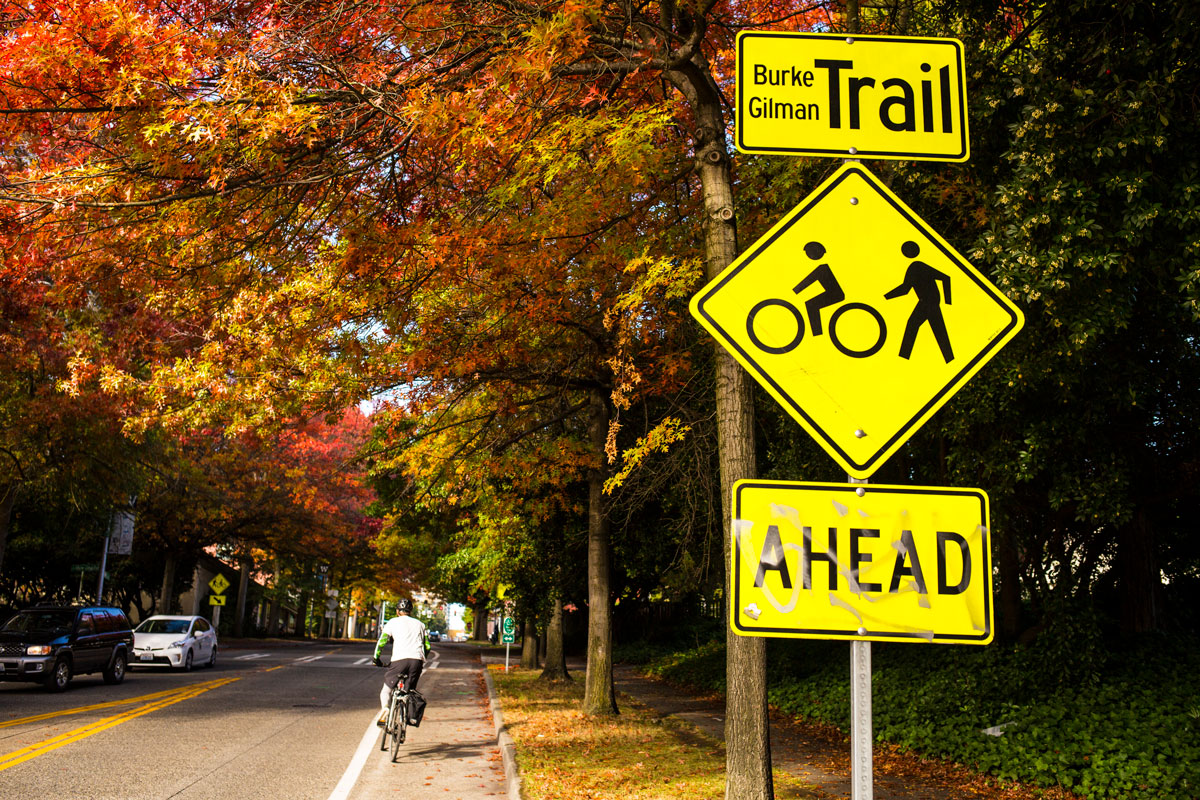
While factors like rain or hills might keep people from cycling on our city streets, one of the biggest barriers is the fear of getting hit by a car. It’s hard to identify the safest routes to ride—especially for beginner cyclists—and all too often, dangerous streets are flagged only after multiple collisions have occurred.
A University of Washington-led team has created ProxiCycle, a system that logs when a passing car comes too close to a cyclist (within 4 feet). An inexpensive sensor plugs into bicycle handlebars and sends data about close passes to the rider’s phone. The team tested the ProxiCycle with 15 cyclists in Seattle and found a significant correlation between the locations of close passes and other indicators of poor safety. Deployed at scale, the system could support mapping or navigating cyclists on safer bike routes through cities.
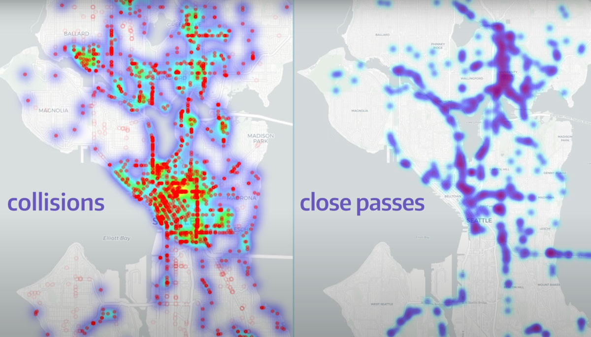
An infographic from UW News shows the correlation between close passes and collisions from cars with bicycles in Seattle.
“Experienced cyclists have this mental map of which streets are safe and which are unsafe, and I wanted to find a simple way to pass that knowledge down to novice cyclists,” says Joseph Breda, a doctoral student in the Paul G. Allen School of Computer Science & Engineering and the lead author on a paper recently presented at the Conference on Human Factors in Computing Systems in Japan. “Cycling is really good for your health and for the environment,” Breda says. “Getting more people biking more often is how we reap those rewards and increase safety in numbers for cyclists on the roads.”
To start, researchers surveyed 389 people in Seattle and found that cyclists of all experience ranked the threat of cars as the biggest deterrent to riding. They also highlighted a lack of road-safety data.
The finding motivated the team to design the sensor system that fits into the end of a bike’s left handlebar. Costing less than $25 to produce, the device is a 3D-printed plastic casing that houses a pair of sensors and a Bluetooth antenna to transmit data to the rider’s phone. The team’s algorithm susses out what’s a passing car rather than a person, another cyclist or a tree.
Although the UW campus is recognized as bike-friendly by the League of American Bicyclists, Seattle streets still pose challenges for cyclists. A UW team has developed a tool to help identify safer routes through the city.
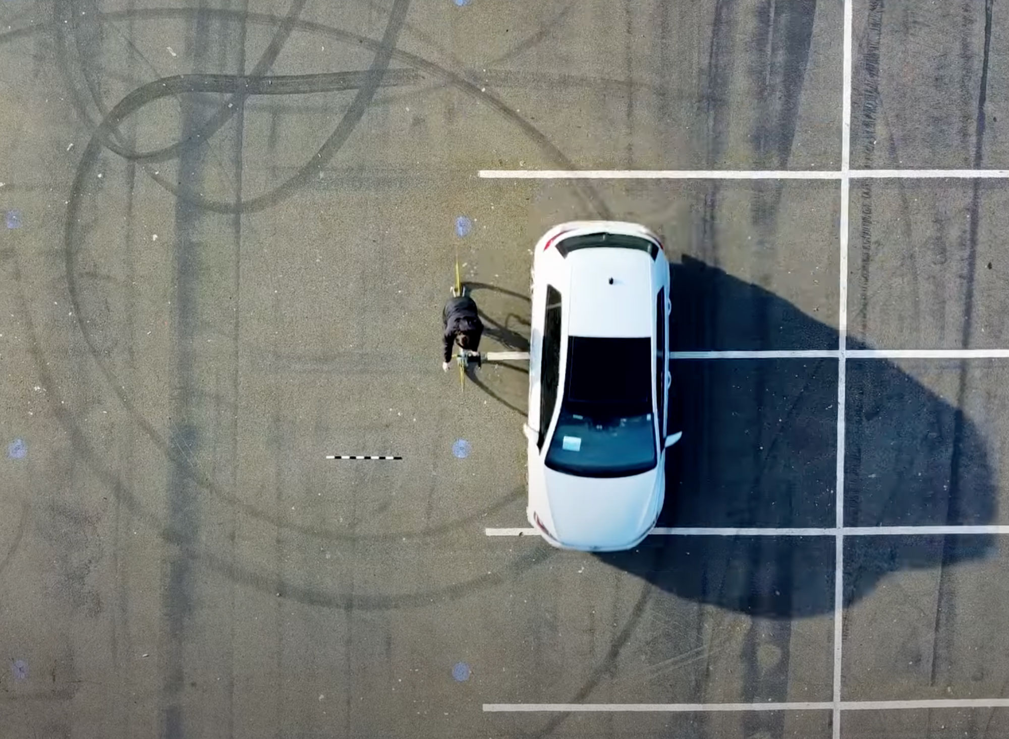
The team validated the system by first testing it in a parking lot with a car passing at different distances and then by outfitting seven cyclists with GoPro cameras on their handlebars as they rode through Seattle. Researchers compared the footage from these rides to the sensor output.
The team then recruited 15 cyclists through the Seattle Neighborhood Greenways newsletter. Each rider got a ProxiCycle sensor, a custom Android app and instructions. The cyclists took 240 bike rides over two months and recorded 2,050 close passes. Researchers then compared the locations of close passes with riders’ perceived safety at different locations—which they measured by showing cyclists images of locations and having them rate how safe they felt at those sites—and with the locations of known automobile-to-bike collisions.
The team found a correlation between close passes and known safety risks. It also found that this measure of close passes was a better indicator of actual safety than the survey of perceived safety, which is the current standard used to study safety when collision data is insufficient.
Researchers hope to scale up to potentially account for other hazards, such as when cyclists are struck by car doors that are opened. With enough data, existing bike mapping apps, such as Google Maps or Strava, could include safer route suggestions based on real-world risks.
Some of those routes might involve only minor adjustments. “One study participant who was living down by Seattle Center was biking down Mercer all the time,” Breda says. “It’s this busy, multi-lane road. But … there’s a great bike lane on a quieter street just one block north.”